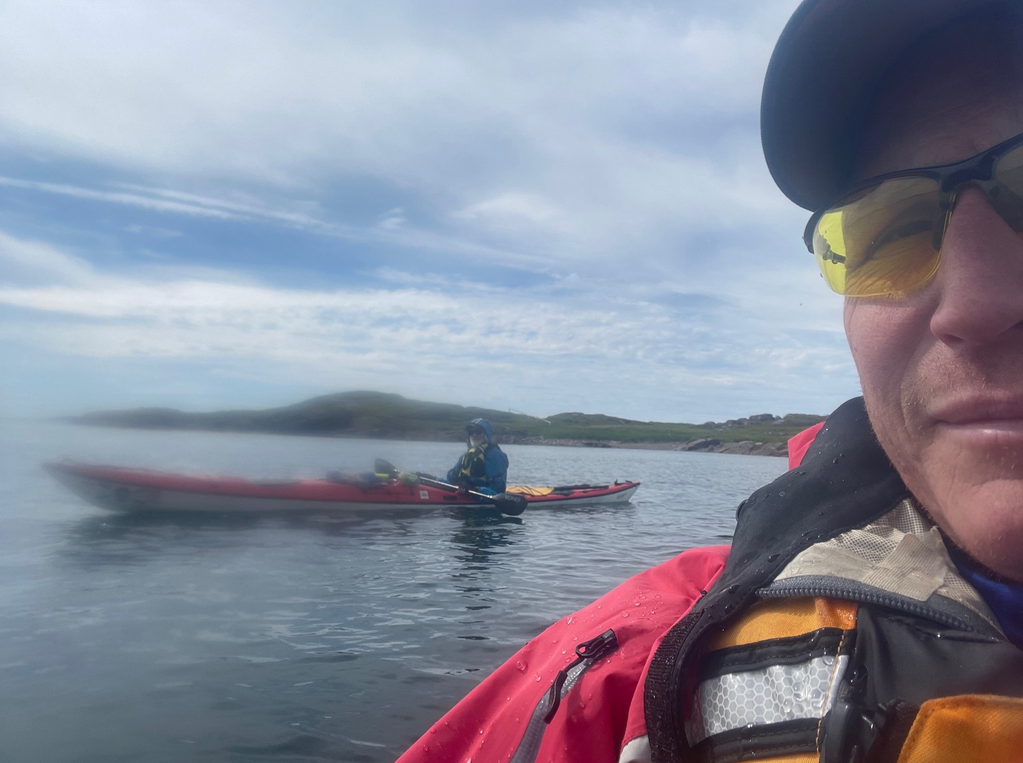
As I drove back down the Viking Trail alone the Sunday after John’s departure, I enjoyed stunning vistas of the sea for long stretches. Once Route 430 shoots west over to Eddies Cove, it hugs the coast of the Strait of Belle Isle for more than 20 miles, all the way to Anchor Point. It then swings around St. Barbe Bay (and the ferry across the strait), continuing down the coast (now along the widening Gulf of St. Lawrence) for almost another 150 miles. Finally, it swings inland along the fjord-like reach of the East Arm (protected to some degree by Norris Point) as it hurtles through stunning landscapes and seascapes towards its terminus at Deer Lake. It was a glorious, blindingly bright morning, and as I drove along the water, I considered the fact that Norse expeditions west of L’Anse aux Meadows would likely follow this counterclockwise route around the Island. I imagined that they would far prefer the protected waterways of the Strait of Belle Isle and the Gulf of St. Lawrence to the much more treacherous route clockwise along a jagged rocky coast pummeled directly by the North Atlantic. The winds in Newfoundland can be severe in any season, and the prevailing ones are from the west and southwest, so the Norse would have had to take that into account, in either case. Certainly the sailing season would not have commenced until the pack ice was reasonably clear, which limits the navigable portion of the year considerably.
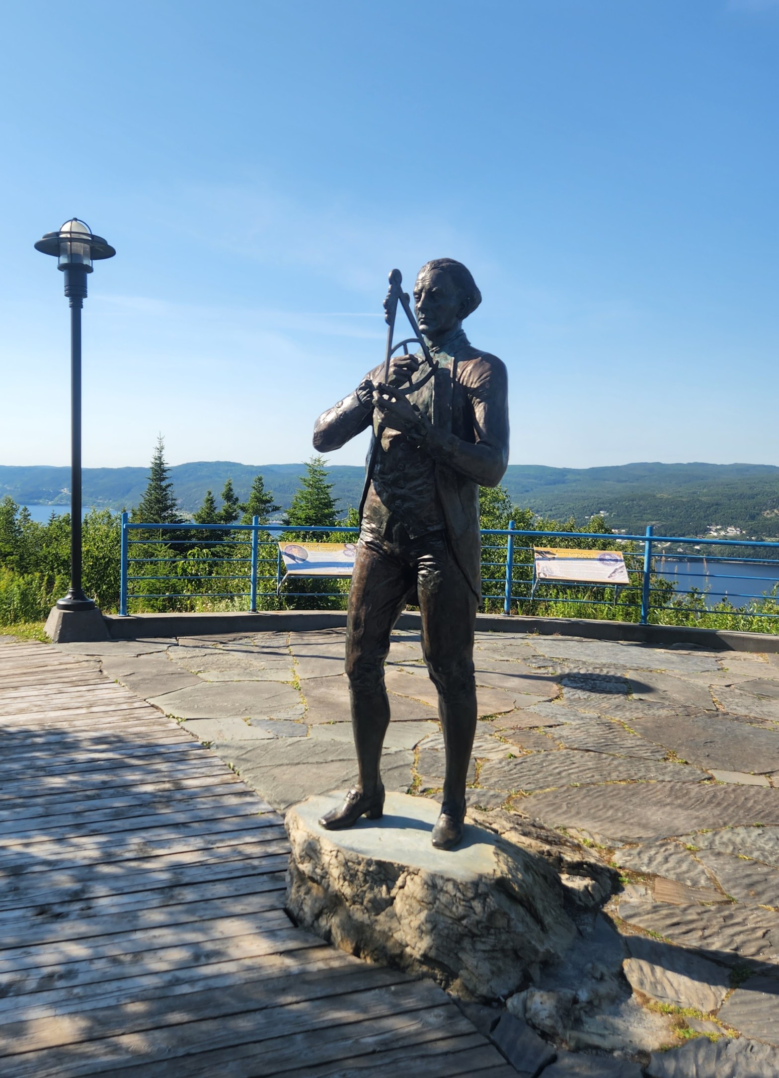
At the suggestion of my old college chum Adam, his lovely bride Tanya, and her sister Joanne, I was due to spend the night in Corner Brook, which would place me just a couple hours from the ferry terminal in Port aux Basques, where I was scheduled to depart late on Monday night. Tanya and Joanne are from Corner Brook, so they kindly offered a number of suggestions concerning how I might profitably spend my time in their hometown, and the one that seemed most aligned with my journey In the Wake of the Vikings was to visit the Captain James Cook Historic Site. A statue and interpretative plaques there commemorate the fact that, before his name became a byword for sailing around and charting vast portions of the globe, Cook was assigned to chart the coast of Newfoundland after the Treaty of Paris in 1763 acknowledged British claims to the Island. The vantage point of the site also gives stunning, nearly panoramic views over the Bay of Islands, the City of Corner Brook, and the surrounding mountains and countryside. It was a spectacular day to take a lovely walk to a beautiful vista, so many thanks to Joanne, Tanya, and Adam! Along the way, I reflected upon our own attempts to chart sections of the coast of Newfoundland. We had done a bit from the water, yes, but also on foot, in the car, and poring over the excellent (although at this point, time-consuming and somewhat challenging to obtain) Nautical Charts of the Canadian Hydrographic Service (CHS). I should let John tell that last story, but suffice it to say that—even attempting to secure charts weeks in advance—we had to make multiple orders, hedge some bets, and finally throw ourselves on the mercy of friendly folks in Labrador to have our charts shipped to us there in time.
I also read and re-read relevant passages of the sagas to look for clues for actual places on the map that we should attempt to visit and to paddle. Some were clearly too far afield for a journey of only a few weeks, but others are difficult to identify with any real accuracy, no matter how many tourist bureaus, local guides, and insistent self-proclaimed experts may assert forcefully to have identified them. Let’s be clear: West of Greenland, the only reliably identified Norse Settlement Site is that at L’Anse aux Meadows, although some recent finds on Baffin Island argue persuasively that the Norse used that landmass—long associated with the place called Helluland (“Rock-slab Land) in the sagas—as a stopover point. More than that we simply cannot assert with any real confidence, whatever we may choose to believe. It is vital to remember that reputable scholars of Old Norse literature, Medieval Scandinavia, and the Viking Age take the saga accounts in general with a large grain of arctic sea salt. The reasons for this skepticism should be readily apparent when one considers the more fantastical accounts of the Norse sagas, which are populated with “Wer-Bears and Zombies and Dragons, oh, MY!” When you fold into this Nordic witch’s brew the controversies around such suspiciously convenient artifacts as the (somehow, against all odds) still somewhat disputed Kensington Runestone in Minnesota and the now utterly discredited so-called “Vinland Map” at Yale, and it is clear that one attempts to follow In the Wake of the Vikings at considerable peril. The channel markers for the journey seem shifting, at best, and one must avoid the false beacons of latter-day historical wrackers in this attempt. The history of Newfoundland provides its own stark warnings in this regard, and, as Gollum might put it, it is vital when such will-o’-the wisps arise that we “don’t follow the lights.”
The sagas, in short, are clearly not “history” as we understand the term. Still, archaeological evidence does at times support some aspects of Medieval accounts, and we must take care not to throw the proverbial baby Viking out with the long-ship bilge-water. Thus, we need to keep both an open mind and a critical perspective. The excellent modern Nautical Charts, based in some measure upon the work originally produced by Captain Cook, offer in this regard a telling counterpoint to the vague but compelling tidbits we may draw forth from the sagas. It should set off alarm bells whenever these tidbits sometimes seem to fill in beautifully the gaps in the evidence that remain to us, a thousand years after the Norse reached L’Anse aux Meadows. We need to be careful, methodical, and rigorous in the assessment of our sources. The sagas sing us a siren’s song, encouraging us to set a course for adventure In the Wake of the Vikings. I for one am glad and grateful for that poetic impetus, but we must not allow beautiful dreams to cause us to ignore hard and fast realities. We must be cautious in our critical assessment of the relationship between literary license and verifiable fact. In sum, we must put our faith in more prosaic charts when we want to navigate safely through hidden shoals.
That was the lesson my visit to Captain Cook impressed upon me.
[https://www.nationalgeographic.com/science/article/121019-viking-outpost-second-new-canada-science-sutherland]
[https://www.smithsonianmag.com/history/did-viking-woman-named-gudrid-really-travel-north-america-1000-years-ago-180977126/]
[https://www.npr.org/2021/09/30/1042029881/the-vinland-map-thought-to-be-the-oldest-map-of-america-is-officially-a-fake]
[https://www.nytimes.com/2021/09/30/us/yale-vinland-map-fake.html]
[https://www.minnpost.com/mnopedia/2020/05/the-kensington-runestone-minnesotas-most-brilliant-and-durable-hoax/]
[https://news.prairiepublic.org/main-street/2021-01-11/secrets-of-the-viking-stone-natural-north-dakota-nd-museum-of-arts-laurel-reuter]
[https://archive.macleans.ca/article/1973/1/1/the-wrackers-of-newfoundland]
[https://www.heritage.nf.ca/articles/environment/climate.php]
[https://www.charts.gc.ca/charts-cartes/index-eng.html]
Speaking of reputable maps, we have plotted many of our adventures on this one:
