In the Shadows of the Vikings: The Sunny Side of the Living History at L’Anse aux Meadows

I plan to write at least two blogs on my impressions of the Parks Canada conservation, interpretation, and reconstruction of the Norse settlement at L’Anse aux Meadows. First, I’ll spin some sugar, and then I’ll throw in some spice.

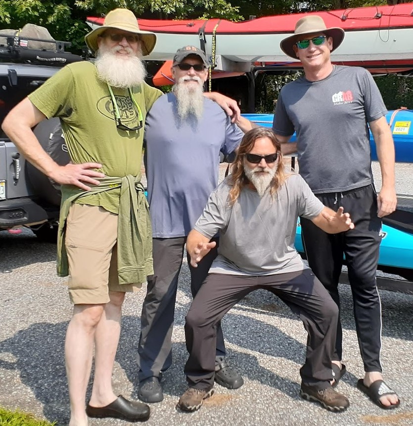
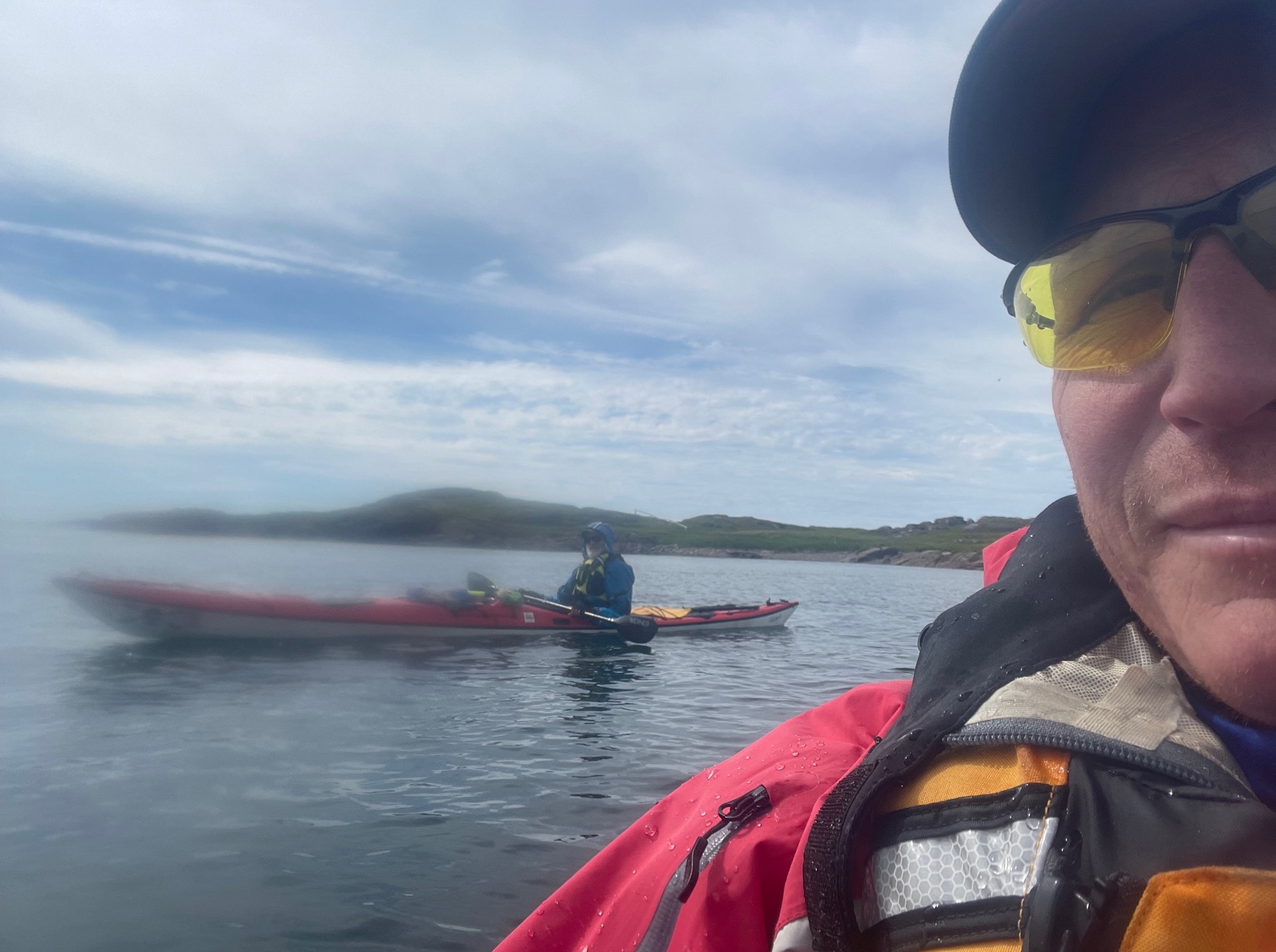
In the interest of full disclosure, I love Parks Canada. The facilities are generally very well-kept, information tends to be clearly and cogently presented, and the folks tend to be über-Canadian-nice. A case in point: When I entered the Visitor Centre of L’Anse aux Meadows on Wednesday morning, I was greeted by a beefy and jovial young man who could have passed for Thor’s little brother. Seriously, regardless of what the comics or movies would have you believe, Thor is hulking, barrel-chested and red-haired, with a big bushy beard, and the flashing eyes worthy of a Thunder God. Look it up. Anyhoo, Thor’s young doppelgänger—let’s call him “Karl”—had chosen not to go all Gimli by braiding his beard, but clearly was considering it to offset what looked like a freshly shaved noggin (an attempt at disguise, perhaps?) When he charged us for our admission, I asked if I could buy a multi-day or weekly pass. “Why’d ya wanna do that?” he retorted, with an endearing slight confusion that reminded me of his older brother. “Because I’ll be coming back several times over the next few days; it’s OK if I have to buy a ticket each day….” “No, no, no!” He cut me off, although in my head I heard, “Nej, nej, nej!” “No need to do that. Just keep your ticket and show it when you come in.” That’s nice, of course, but that’s hardly the end of the story. Late Saturday afternoon the light was just glorious, so I decided to take one last jaunt down to capture a final image or two of the reconstructions at the settlement site. I’m staying just a couple of miles away, so I went on foot. I misjudged the time, however, and I arrived at the Visitor Centre just before closing time. The guy working the desk, in fact, was looking down at his phone as he called in a pick-up order for ten minutes later. Just beyond him, however, I saw Karl, so I made a bee-line to him, reminded him of our earlier conversation, and asked if I could run down and take a photo or two in this perfect light. “Sure ya can, but we’re locking up here, so you’ll have to go out the long path,” says he, poking a finger at a line on the park map clearly marked, “Restricted Access.” “Take yer time and take yer pictures.” “Oh, I can use that access to the main road?” I asked. “I thought it might be illegal….” “No, no, no…it’s fine….” He replied, as he waved me on my way. I went down, took my time, and got some beautiful shots. I followed the path he had indicated, which dumps out on the main road right by a set of car-charging stations. Electricity? Thunder God? Coincidence? You be the judge….

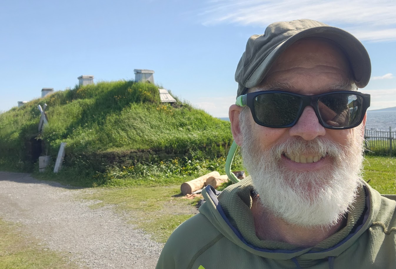
In any case, my point is that I am predisposed to have a very positive view of Parks Canada in general, and of this site and its staff in particular. Everything is well-explained and contextualized, the staff is welcoming and helpful, and they make it fairly clear that they have based their work on a relatively tiny sample of actual material evidence. That’s par for the course in the diaspora of North Atlantic Norse sites, however: Since we are not dealing with the tumbled-down ruins of large stone edifices (as often one might find in the Classical World, for instance), but rather with the low-mounded foot-prints of wooden-framed, turf-walled structures, archaeologists mainly have “post holes and midden heaps” left to analyze. That means that although they often can sketch out the outlines and interior partitions of buildings with great accuracy, the rest is much harder. Basically, since wood and turf have burned, rotted, sunken, and otherwise degraded over the past thousand years in wet, marshy conditions, archaeologists have to rely upon more fruitful finds from other digs, as well as written records to flesh out their knowledge. Added to that may be some insight gleaned from building practices that have abided with relatively few changes over time until recently in some traditional communities, for example, some outlying setlements in the Faroe Islands.

The reconstructions that sites like L’Anse aux Meadows build to help interpret the original settlement for the public are therefore the product of years of shifting evidence. In fact, one of the reenactors on-site this week discussed with John the current state of the shifting knowledge and general opinion about venting and smoke-holes in structures of this type. Over the coming few years, he added, the reconstructions at L’Anse aux Meadows would come to reflect these changes. There is also a severe paucity of material objects found in situ to inform us. This is not unusual either, however, because folks surviving on the very edge of their known world use and use and then repurpose tools—especially those of iron—until there is nothing worth saving. And people who move away take everything of value with them. Only what is left, or lost, or forgotten tends to remain for us to find on the trash pile or elsewhere around the living area. The remaining gaps are filled by best guesses, collating with information from other sources and sites. It’s a constantly evolving process, and it’s unrealistic to ask for perfection, at least until Mr. Peabody and My Boy Bret complete the Way-Back Machine so that we can go and check their work.

That all acknowledged, it’s fair to say that the scientists and staff at L’Anse aux Meadows have done very well with what little they have. Their interpretation tends to be engaging and even occasionally exciting, which is a crucial part of the job description of those of us who try to bring the past to life. The reconstructed buildings themselves are impressive, evocative, and to my mind fairly accurate in their attempt to portray Norse life in that time and place. The reenactors themselves are solid. They are not quite at the level of say, the trained craftspeople at Colonial Williamsburg in Virginia, or the shipwrights in the Boatyard of the Viking Ship Museum in Roskilde, Denmark, but the folks at L’Anse aux Meadows were entertaining, interesting, and thought-provoking, and I very much appreciated their dedication, knowledge, and welcoming spirit.

In short, both this paddler’s thumbs are up for visiting L’Anse aux Meadows. I’ll give a more nuanced criticism of some specific aspects of the interpretation of the site in a later blog.

Follow along on our ongoing adventures on this map:

https://share.garmin.com/IntheWakeoftheVikingsCFee

Keep up to date with our adventures and follow our movements through our blog:

https://www.pc.gc.ca/en/lhn-nhs/nl/meadows

A Word of Thanks to Some Salty Sea Dogs from an Old River Rat

There’s still plenty of adventure to come and many tales yet to unfold, but earlier this week John and I were reflecting on what a long, strange trip it’s been—literally as well as metaphorically—and it occurs to me that some heartfelt thanks are due, and sooner rather than later. I couldn’t possibly have made this trip without the rest of Team Viking: John, Russell, and Tim. For those of you who haven’t cottoned on by now, this Old River Rat made his bones on fast-moving rocky inland waterways, and Ol’ Ratty will never truly be at home on the Big Salty. John and Russell and Tim made heroic efforts and great strides in this regard, and any small success I have or will enjoy in this endeavor must be credited in large measure to them. Thank you, brothers. For those of you who did not come of age in a giant old aluminum Grumman owned by Big Chuck Smith, just believe me when I say that the skills are not immediately transferable. I mean, in most conditions I can keep my boat upright and keep it on course and paddle until my Ratty heart explodes, but the techniques that are second nature to me are simply too energy-intensive and inefficient in a kayak of any kind, and most especially in a long, fiberglass sea-kayak with a skeg. If any student every brought ol’ RAF close to the end of his tether, it was yours truly. But he persevered, and I improved, if only to a point of modest adequacy. John always has been likewise patient beyond words, although we know each other far too well for me not to get the vibe when I’m pushing him near the edge. And Tim, Dear Sir Tim, took the time to be sure that this massive and creaky old frame could well and truly affect a wet exit and self-rescue in the surf. Again. And again. And again. If you are of my size and age and haven’t spent many years getting in and out of a sea-kayak smoothly and easily, upside down and underwater, in swell and surf, it ain’t the easiest skill to master. Yoga helps, but not nearly as much as one might hope. Heartfelt gratitude, Tim. So thank you, Viking Brothers, and thanks to all Honorary and Auxiliary Vikings and our dear Vikettes, for all of the steadfast support. And to my brothers of the wooden paddle, JBW and Friend Jan and FPRRG (Former Professional River Raft Guide) Bunkie and Bret-Dog and all the others: River Rat Love! I want to close with a shout out to the Smith Boys, Big Chuck, Little Chuck, Matt, and Billy, who along with my own big brother Pat instilled in me a passion for swift-moving water, and a fearlessness born of the simple childhood faith that ain’t nohtin’ gonna sink a million-year-old Grumman. It was a real gift, and I am truly grateful. Thanks for the memories! And now back to our regularly scheduled program.

Follow along on our ongoing adventures on this map:

https://share.garmin.com/IntheWakeoftheVikingsCFee

This is “It:” Team Viking’s Flow Moment at L’Anse aux Meadows

An evocative experience right before we landed at L’Anse aux Meadows triggered a set of powerful memories and took me many years back in time. “What is It?” Sheena Gibson had exclaimed while on one of our ten-day sea kayaking trainings for Gettysburg College in the mid-2000s. The seasoned student facilitators would often talk about “It” in reference to the program and the personal journey they were experiencing. You would hear them say phrases like, “you will know It when you feel it” or “I had another It moment today.” And the newer staff members were consistently confused and would retort with, “what is It, and how do I get it?

“You will know, on the day it will happen…that is the power of It, and it is because of It, that we facilitate these experiences.”

For those of you wondering, Sheena eventually experienced It.

I have witnessed and heard of many It moments. It happens often on the Gettysburg Battlefield, while working with my professional leadership groups, when people take a pause and slowly wipe tears from the corners of their eyes. Or along the beaches of Normandy while guiding a trek, when someone suddenly stops and, with poetic grace, places the outstretched palm of a hand on the sand. Or witnessing someone watch the sun slowly disappear behind the reeds and calm water on the Sound of North Carolina on a cool spring evening. In those moments, it is hard to articulate what It is like for them, though I can say that It happened. There is a sense of power that comes with place, space, triumph, and tragedy, coupled with the opportunity to pause and let that moment consume and ground you. I myself have had many of these It moments, which is why I still desire to be in the field and create the space and opportunities for others to continue to acquire personal insights and evolve their sense of self and purpose.

This brings me back to the present. As I said, I often have experienced these moments, but not to the degree I felt when Chris and I launched to visit L’Anse aux Meadows. It was strange, and I certainly was not expecting to become overwhelmed with emotion. We found a little cove on the far side of the Meadows and put our boats into relatively calm water. The tide was coming in, and the breeze was discernible on the water from the port side of our kayaks. There were steady ripples along the top of the water, and we could see rocks in the distance start to disappear. We launched and paddled to the north a bit to avoid a rather large rock garden and then headed westerly to Warren Island. I shouted to Chris across the water to land on the island so we could see what the Norse would have seen when coming into the Meadows. With an uneventful landing, we jumped out of our boats, and I found a route through the ground heather to a rocky perch. It was a good position to gain a great perspective. I could see more islands to the north and had a panoramic view of the harbor. Thinking Chris was right there with me, I turned around only to say, “where the hell are you? Where’d he go?”

Squinting, I could see my dear colleague still down by the boats looking at his phone. Chris looks at either his phone or watch in a very distinctive manner. He stops dead in his tracks, tilts his head low so he can peer over his glasses, and holds the phone inches from his face with both hands. I could see him in this slightly hunched position, in his blue dry suit, from atop the outcrop. I hustled back down because I didn’t want the seagulls—who clearly owned the island and were none too pleased with interlopers—to start and take aim. They were pretty agitated with me. I arrived at the shoreline just in time for Chris to turn and state, “it’s over there, around that peninsula,” as he pointed southward. “I think we need to go through those rocks there, and then the mounds are on the other side.” At this point, the blue dot on Chris’s phone had us locked in on Warren Island with the enlarged map identifying the settlement. He was fixated, and I could sense his energy. For four years, we had been talking about this experience. As Russell had advised us, “when we get to L’Anse aux Meadows, the first time you see it has to be from the water.” Now we were less than 500 meters away.

“There are a set of rocks to the left and then another to the right; we will need to split the difference and go directly between them,” I said as we discussed our route to the settlement site. In agreement, Chris got back into his boat and launched. I told him I would be right behind him, though first I would take one more photo. I snapped a picture, zipped up my PFD, looked up, and “…where did he go?” Chris had made off, as my father would say, “like a bat out of hell.” I could barely see him against the chop of the water and the misty sky, but really because he had decided today, at this moment, he would paddle at Mach 2. 

I jumped in my boat, put my blade in the water, took two strokes and stopped. I had to pause. 

The tears welled up behind my glasses, and I could sense that my heart felt full. It hit me. This was the culmination of triumph, tragedy, and opportunity. Years of conversation, discussion, training sessions, deliberation, and most importantly, an idea coming to fruition, a vision brought to life.

The real It for me, however, was in response to the overwhelming rush of pleasure and genuine happiness floating on a tiny bay just off the Labrador Sea while watching a dear friend and colleague, an incredible father and husband, and a charismatic academic leave me in his wake, because he was experiencing his moment of flow. 

Follow along on our ongoing adventures in ten-minute intervals via this link:

https://share.garmin.com/IntheWakeoftheVikingsCFee

Fire GOOD!!!!! Blackflies BAD!!!!!!!!!!

We pause now in our earnest reflections upon our experiences In the Wake of the Vikings for a heartfelt testimonial. Over and above the marine conditions with which we have had to contend in our boats, over the past weeks we have encountered a wide range of camping conditions throughout the South Labrador Coast and the Great Northern Peninsula of Newfoundland. These have included most notably wide (and sometimes speedy) fluctuations between dank cold and moist warmth, gale force winds, torrential rains, and, of course, the dreaded blackflies. The seemingly somnolent mosquitoes I am swatting away occasionally as I write these words seem like rank amateurs in comparison. Frankly, I pity the fools. Throughout all these conditions, however, the unsung hero of our nightly comfort has been our beloved Ignik Firecan. Obviously, those amongst our readers hiking in the backcountry or engaging in long pack-and-paddles are not going to be able to avail themselves of this little beauty and its compact accompanying fuel tank, but for these two rapidly aging old-timers base-camping it, it’s been a metaphorical lifesaver and an actual Godsend. In Labrador it provided much needed warmth quickly and effortlessly when we came back chilled from the water, and—perhaps more significantly to our spirits—it drove back the worst bulk of the blackflies within the small “no fly zone” beneath our fly. In Newfoundland, it was especially handy the day and night after a wild and woolly storm first blew away our fly and then soaked a bunch of our gear. After resetting our fly with the heaviest items in our possession, we fired up “The Little Ignik that Can” and cranked it to the max, which really helped dry our sodden gear in a resolutely damp environment. I should also note that (although no one else could see it in our secluded campsite in Labrador) here in our much more exposed location in Newfoundland, the Firecan has been the single object of gear that has solicited the most admiration and unsolicited positive comments. People see the flames from a distance, wander over, and talk to us about it nearly every night. My paddling buddy John has decades in the field, and nearly thirty years leading, guiding, and consulting about every aspect of outdoor experiential education at every level, and he can be a cynical, cantankerous old coot when it comes to trendy new gadgets. In this case, though, he has been converted into a True Believer. In John’s words, uttered one night when we had gone from miserable to merry in about thirty minutes, “man, this thing is the frickin’ BOMB!” Old Man Fee concurs with his estimable colleague. I should emphasize that this testimonial was not solicited. Although Ignik have been enthusiastically supportive (special shout-out to Indigo in this regard!) and have given us some gear, the Firecan and the fuel canister we use with it were not given to us, but were purchased at a pro-deal discount. We actually, truly, sincerely love it, and any would-be haters out there can sit in the cold, wet, dark, covered with blackflies, and think about their choices.

Follow along on our ongoing adventures in ten-minute intervals via this link:

https://share.garmin.com/IntheWakeoftheVikingsCFee

At Long Last, Team Viking Glides along the Whale-road to L’Anse aux Meadows

Today marked the culmination of a dream several years in the making for Team Viking. On August 13, 2018, quite nearly four full years ago, I received what is called “the good news letter,” by the Office of the Provost of Gettysburg College. It informed me that I was eligible for a sabbatical during the course of the 2020-21 academic year. I hadn’t yet heard of COVID, of course, and few of us could have imagined how the next couple of years might unfold. But then again, none of us ever truly realize all the perils that lurk like the sails of a Viking longship fleet just over the horizon, do we? Still, we get on with our lives and we make our plans the best we can. Soon after receiving that letter, I approached John Regentin about bringing his vast experiential educational expertise to a joint project tentatively entitled In the Wake of the Vikings: ReDiscovering Norse America. John jumped at the chance to collaborate with me again, this time on an adventure-based experience ultimately designed to result in a book that reexamined and reinterrogated the Saga accounts and archaeological and other evidence of the Norse ventures to and in North America. We hoped to emphasize viewing the Norse accounts and settlements from the perspective of actual sea-farers, paddling 18’ sea-kayaks along the coast of Labrador and eventually visiting the only known Norse settlement west of Greenland, that at L’Anse aux Meadows, on the Northeastern tip of the Canadian island of Newfoundland. John assured me that looking deeply at highly localized realities concerning prevailing winds, currents, tides, and shifting coastlines, sandbars, and rock formations along relevant lengths of coastline and notable bays, coves, and river estuaries would inform our study in visceral manners that one simply can’t discover in a library or through a Google search. How right he was: The sea is immense and ever-changing, often downright terrifying, and local knowledge and insight is the gold-standard currency of those who would be successful in understanding the realities of those who navigated its pathways before us. John also insisted that we rope in his old pal Russell Farrow, a world-class paddler who had helped John to lead a group of Gettysburg College kayakers across the Baltic from Stockholm to Helsinki a few years before. Russell and I had met through John a couple of years before that when he helped to facilitate a faculty paddling excursion in Lake George that John and I had envisioned. Soon the three of us had bounced some ideas around with Michael Leaman at Reaktion Press, and after taking us down a peg or two and making us think more rigorously about the structure of our work, Michael was kind enough to offer us a contract for the book. In any case, Russell was invaluable to us in many ways, too many to enumerate here. I would be remiss if I didn’t mention, however, that these certainly included his vast experience paddling around Baffin Island and in Northern Labrador, his skill and patience as a gentle guide and mentor, and his quiet wry wit with and fierce loyalty towards his friends, among whom I am humbled and privileged to number myself. In any case, we were derailed first by COVID, and then by the unexpected loss of the elder statesman of our little ragtag band of Viking paddlers. If ever the Valkyries chose a warrior in his prime, it was our RAF. Today, therefore, is a celebration of Russell, who—quite early on in our long and rambling conversations about our planned expedition—looked me straight in the eye and said, “ya know, Fee, the first time you set eyes on that place, it’s GOTTA be from the water….” That is what we did today, and that is why it matters so much to us. Russell, how right you were, brother! Today John and I followed in your wake as well as in that of the Vikings. As I taught you to say in Icelandic, Skál! Tonight we drink our mead to your memory!

Follow along on our ongoing adventures in ten-minute intervals via this link:

https://share.garmin.com/IntheWakeoftheVikingsCFee

Getting into the Flow, Viking Style: Flat, Oily Calm

The plan for Sunday was to organize gear, wash laundry, shower, and then paddle later in the day. While Chris was taking care of his personal private business in the morning, I decided to walk to the shoreline, first, to assess the water and weather conditions and second—no, maybe first!—to get the heck away from the unforgiving blackflies. These little creatures are certainly dedicated professionals and perform their tradecraft with incredible tenacity. After a week on the Labrador Coast, I look like two of my adolescent worlds have crossed paths: I now resemble the unholy lovechild of chickenpox and acne. I am not wearing a baseball hat because I am having a bad hair day; I’m having a bad skin week, and I have regressed to my youthful insecurities that people will point, gawk, and make fun of my forehead. And the same goes with long pants. These legs are so not sexy anymore.

This is part of exploration; we speak excitedly about our interest in learning the stories and narratives of those we meet, and it turns out this blackfly narrative is a common theme up and down the coastline. On a side note, I learned not to say north and south when referring to the coast of South Labrador. A curt “we don’t use ‘north’ here,” from Ruby the Ranger—who dismissively eschewed netting herself—was enough to teach me this lesson.

Any expedition has a moment when the honeymoon is over; this is largely because, along with the excitement of pushing the edge comes the stark realities of nature and the environment at hand. Blackflies, these petite terrors, are a legendary part of the Labrador experience. Though we throw on bug netting and go into covered spaces, early inhabitants of the region had to deal with the consequences of insect menaces, which could cause sickness, disease, or at times, death.

As the wind blew the cobwebs out of my brain and the blackflies off of my body, I suddenly realized that the water looked to be just about perfect for paddling right there and then. In Labrador, when the conditions are good, you go NOW. I called to mind the words of Trent O’Brien, the mayor of L’Anse Au Loup, that when the water appears placid it known as “flat, oily clam.” Sunday morning, the water looked “flat oily calm” from Labrador across the Strait of Belle Isle, all the way to Newfoundland. After Chris assisted me with launching my kayak, and resisting the powerful urge to jet directly across the Strait, I decided to go “down” the coast (not “south”) and then work my way back up the Pinware River. When I launched along the Pinware beach, five fishing boats were in the harbor. I steered clear for many reasons, mainly because all I am in the water is a speedbump if the captain of the vessel cannot see me against the light.

I then settled into a rhythm and soon lost myself in the Flow. Mihály Csíkszentmihályi, a Hungarian psychologist, is known for his research on the concept of Flow. It is the moment when one’s skill level aligns seamlessly with the challenge at hand, creating a sense of timelessness, happiness, full engagement, and the ability to participate in said experience as if on autopilot.

When there is not enough challenge in one’s life or in the activity at hand, one can simply become bored. If the challenge exceeds one’s skill, that experience can be anxiety-provoking, as noted by Csíkszentmihályi. The challenge was low when I first put my blade in the water, and the only thing on my mind other than being a momentary thud under the hull of a trawler, was how far out can these damn blackflies fly? Seriously, those tiny wings were impressive, though finally, I out-paddled them. It is common to ask, “what are you thinking about?’ while paddling with a partner, and what follows are moments of dialogue. In the case of solo paddling, for me, it is like ADD on steroids, and in part, that depends on where I am in my Flow state. If we were able to rewind the tape, it could sound something like:

“five boats, head for the point, com’ on blackflies get the, check the skies, look left, look right, I need to scratch my leg…oh, ok, good luck with that, how far, maybe the lighthouse, three coves, safe or too exposed, split the difference, Nigel and Russell, go more inland, I got…holy smokes that caught me off guard, lost the Flow, lighthouse, yes the lighthouse, jellyfish, no whales, come on whale…where are you, are my kids awake yet, can I get a selfie out here?”

And so on.

In short, the paddle was splendid. I set the initial course to cross over three coves to a small lighthouse (actually, a channel beacon) positioned on a rock cropping 150 meters offshore. I remained fairly close to the shore in case the weather became more dynamic, and also to see what the coastline had to offer. When I approached the lighthouse, the channel was more aggressive, with the swell ricocheting off the coast, then recoiling off the lighthouse rocks which turned into an unchoreographed dance. Nope, no more Flow state for me. I worked through the dance, trying to keep my grip relaxed, and my posture and form at ease. It was only for a few minutes, but enough to challenge some skills I had not used in a while. After I rounded the rock island and pointed my deck compass to 30 degrees, I decided to stay further off the coastline on my return. I realized I needed to dance a bit more, and doing so required me to stay outside the coves and my comfort zone. I kept a keen eye on the weather, the fog off in the distance, and the swells around me. The wind was to my back, the seas thrust me in the direction of my heading. I held the edge of the kayak as I turned into the river’s mouth and caught the incoming tide into the Pinware River basin, back to flat oily calm.

Follow along on our ongoing adventures in ten-minute intervals via this link:

https://share.garmin.com/IntheWakeoftheVikingsCFee

The View from the Twig: The Sense of Awe and Isolation Endemic to Labrador

We chose to stay at Pinware Provincial Park for a number of reasons, not least of which was proximity to the coastline and bays of Southern Labrador, as well as easy access to the easternmost point of the mainland of continental North America. It also is a breath-takingly beautiful park in its own right, with lovely campsites and the sounds of both the river and the surf, which ALMOST makes up for the blood-sucking parasitical marauders known as blackflies. But I digress. Pinware was also perfect for our purposes because it is located on a peninsula formed by the wide mouth of a river as it enters the Strait of Belle Isle, which means that there is a natural seawall between the protected river inland and the cove on the seaward side. This sort of geographical feature would have been noted by the Norse, who would always have been seeking safe anchorage, as well as sources of fresh water and timber. Any Dane might also note the similarity between the ever-shifting sand-spit at the moving boundary between sea and river and the similar feature at the very northernmost tip of Jutland. Known as “Grenen,” “the twig” or “the branch,” that weaving sand-spit demarks the border between the Baltic and North Seas. It was perhaps a memory of standing with one foot on either side of Grenen in 2009 which drew me out to the very point of Pinware one afternoon. This caused me to stand with my feet astride the very end of the long whip of sand as it was moved back and forth by the clashing forces of tide, current, and wind. At first I was facing out towards the strait, searching for Newfoundland through the mist. As I turned back to look at the beach and the river on either side, however, I was struck immediately by how isolated I felt, and how much the surroundings seemed like true wilderness, even though there were people and roads and fishing boats and even small towns just out of sight. I was a powerful feeling, though, and I was awestruck by the enormity of Labrador. The Norse must have been, as well, although they were also mistaken in the impression that they were anything like alone in this rugged and beautiful vastness. We’ll talk about some of the consequences of such misapprehensions at a later point. I leave you today with my impressions of the enormity of Labrador.

Follow along on our ongoing adventures in ten-minute intervals via this link:

https://share.garmin.com/IntheWakeoftheVikingsCFee

A Viking Reverie on the Threshold of the Labrador Sea

Today Team Viking did an out-and-back paddle from Mary’s Harbor, following the coastline from the boat launch at the inner harbor to Shoal Cove Head near the opening to the sea. It was a beautiful paddle with clouds overhead, mist in the air, and temperatures hovering in the mid-50s. The water leaving the harbor was calm, although as we worked our way to the point, the chop and headwinds increased, causing us to adjust our stroke and to edge our boats accordingly. I turned my kayak away from the shoal and pointed it toward the open Labrador Sea; next stop Tralee, Ireland, if we headed due east, or Greenland, if we headed east for a bit and took a slight left turn. 

When we arrived at the boat launch this morning, Chris engaged in conversation with a local fisherman, and simultaneously I met an elder of the community whose grandfather had come from England; his father was born in Mary’s Harbor, and he was born and raised there, as well. I appreciated our interaction at the boat launch as we put on our kit, decked out our kayaks, and prepared to launch. The older gentleman looked at the sky, and in his thick Labradorean dialect, made some mention of the weather. The environment triggered a memory:

Suddenly I was transported back to 2012; June 21st, to be specific. More importantly, it was Mid-Summer, 2012—the celebration of the Summer Solstice throughout Nordic lands. Russell and I had paddled ahead of the group as we all agreed to seek a location to experience the Mid-Summer tradition. This was the day’s priority, even if it meant taking us off course for Helsinki.

We were still in the waters of Aland, an archipelago province of Finland. The hours were waning. Large bonfires were being lit along the shorelines, and you could sense that there was energy in the air. Russell and I turned at one island point, noting that we should be able to find the town we were looking for just to the west of our location. As we rounded the point, off in the distance, there was a residential dock and what appeared to be 15-20 people sitting down enjoying a celebratory dinner at a long table. Russell and I were intrigued, but we kept a bit of distance to avoid disrupting the group. One woman stood up, looked directly at us, and waved us over with large gestures. We smiled at one another and did not miss a beat, maneuvering our Whiskys in the direction of the festivities.

We soon got within calling distance of the dock, with our boats floating next to one another. The woman and her guests were up out of their chairs and dressed spectacularly. It was a sight from Nantucket or the Cape, perhaps. Shades of Jay Gatsby, even. “Where are you from?” she asked, and Russell promptly shouted “Florida!” with a beaming smile.

“Florida!?!” she exclaimed, “what are you doing here?”

“Paddling from Stockholm to Helsinki,” Russell replied in his trademark matter-of-fact tone.

Looking somewhat perplexed, astonished, and curious, she and her friends asked if we would like to join them for dinner. We replied that we were not alone; a group of eight more floated just out of sight. That did not matter to our hosts, as it was Mid-Summer, and it was time for friendship and celebration. And thus, with a heartfelt expression for his home state, Russell opened the door for the 10 of us shabby-looking paddlers to share an elegant meal, to have a place to set up camp, and to spend an evening celebrating Mid-Summer on an island somewhere in midst of the Baltic.

A burst of wind snapped me out of my reverie, and I reluctantly turned my bow back inland. My paddle had tasted the salt of the threshold of the Labrador Sea, and I had felt a mist blow from distant Ireland. It was enough for one day. On our way back into the harbor, I thought more about our morning interactions. It was starting to mist more heavily, and all you could hear were the blades of our paddles dipping into the water. As we turned in from the outer reaches of the desolate seashore and returned into sight of town, the homesteads, fishing boats, and brightly colored out buildings struck me the most. I wondered about the families that occupy the beautiful homes that make up this community and wanted to know more about their stories.  We offer heartfelt thanks to the two gentlemen for the kindness they showed us, however fleeting, with their cordial hellos as they welcomed us to their community, a generous act that made us reconsider the meaning of that word.

Follow along on our ongoing adventures in ten-minute intervals via this link:

https://share.garmin.com/IntheWakeoftheVikingsCFee

Navigation, Viking Style: Prodigious Memory, Long Experience, Respect for the Elders, and the Luck o’ the Norns

Modern navigational technology can seem little short of miraculous, and there is little doubt that it saves time, trouble, and lives every single day. That said, it is far from perfect. Charts can be lost, misplaced, or destroyed; although you may order them in plenty of time—ahem!—they may get to you too late, and even the most detailed charts may not be entirely accurate nor contain all the minute local information you may find you need. GPS is very good, but far from perfect, and signals can be lost and electronics compromised. Even the tried and true compass has its limitations, as anyone trained to use one learns early in the process. As John noted in an earlier post in which he thanked Janice and Trent, amongst others, experience and local wisdom based on traditional knowledge can prove vital supplements, adding insight, color, and details of conditions not always captured in charts, or even in weather reports. Sage wisdom offered by returning travelers can also prove helpful, such as that gifted to us by Jim Taylor, who offered crucial insight based on recent experience.

The point of this blog is that this sort of collective wisdom and group memory was at the core of Viking navigation and exploration. The sagas are replete with information passed on from one voyager to another, and even when taken with a grain of salt, these often might help to provide a fuller picture of what might lay over the horizon in terra incognito. The Norse did not have charts as we understand them, nor did they rely upon the compass. Nor did they know how to fix longitude, although (when visible!) the sun and the stars could guide them reasonably well. In general, however, the Vikings crossed the Atlantic by what we would term latitude sailing, moving roughly from east to west from one landmark, waypoint, or island to the next, often according to a memorized schedule of days for each leg of the journey. They would have to adjust for calm, storm, sunless days, and the like, largely by educated guesswork, drawing upon generations of accumulated wisdom. They might also rely upon tell-tale bits of flotsam and jetsam, the types and movements of birds and aquatic animals they encountered, the direction and force of the wind and swell, and even the color and taste of the water. This is all to say that—although as this very blog and its concomitant satellite tracking map certainly attest!—as much as we have utilized and embraced any and all available technological aids on our journey In the Wake of the Vikings, we have also tried to emulate the ancient Norse respect for local knowledge and traditional wisdom.

Follow along on our ongoing adventures in ten-minute intervals via this link:

https://share.garmin.com/IntheWakeoftheVikingsCFee

Team Viking Follows Local Advice and Explores the Attractions of Red Bay on the Labrador Coast

Janice, the Queen Bee disguised as the town clerk in L’Anse au Loup, on the Labrador coast, greeted us warmly on a cold, blustery day. It was blustery to those from Pennsylvania and probably not so much to those who inhabit this northern territory year-round. We told Janice we were looking for the library to set up shop to write and conduct research, though Janice quickly informed us that the library was closed. However, without missing a beat, she said she could pull a table into the hallway next to the library so we could work from there, strategically positioning us closer to the Wi-Fi to ensure we had the strongest signal possible

As we made our acquaintance with Janice, and we mentioned the purpose for our visit to the coastline of Labrador, and she commented on the young kayaker who went missing a few years ago. He wore a dry suit and personal floatation device (PFD), and though his kayak was retrieved in the cove south of our location, L’Anse Amour, his body was never recovered. Janice’s husband is a Canadian Ranger and was part of the search team during that event.

Janice gave a few concluding thoughts before we set up our makeshift office. She mentioned that Labrador has a unique microclimate and a mind of its own. This was clearly a stark warning, presented with a motherly smile and a strong sense of care. Grace and Carol, Janice’s aunts, corroborated Janice’s point the next day at the Point Amour Lighthouse. They each reinforced the kayaker saga and the need to pay attention to the winds and currents. Later that afternoon, Trent O’Brien, the mayor of L’Anse au Loup, voiced the same concerns. We took all their local wisdom and experience into account, and we have been even more careful than we usually would be. After being here for a few days, wanting to get on the water and explore the coastlines, bays, and tributaries, we have at times found it incredibly difficult, due to the unpredictable weather and the nature of the prevailing winds. But we have kept to best practices at all times, and have solicited and followed local expertise.

We certainly did our due diligence and read about how one needs to be astutely aware of Mother’s Nature temperament, though it is not until you are here can you appreciate how volatile this place can be. I have even read that people sometimes have given up on their weather radios since the weather can change so drastically multiple times a day.

On Wednesday, we experienced land gusts up to 40 km per hour, and while on the water in Pinware Bay, we could barely paddle back to our launch location due to the strength of the headwinds. We concluded at that point that we should head out very early if we want time on the water. The morning of Friday, 15 July, we did just that, and found the water to be remarkably calm inside Red Bay. The skies were clear, the sun was warm, flags rested on their flag poles, and I could see Newfoundland across the Strait of Belle Isle. That all changed soon enough, of course, but we enjoyed these optimal conditions while we could. I have to say, when I look at the crossing from Labrador to Newfoundland, it is calling out to me. It appeared achievable, at least early this morning. “It is a nine-mile crossing,” I said to Trent O’Brien yesterday, and he jovially responded, “more like 15 when you take into account the tides and winds.” It was a good laugh, and instructive.

Today we did get to put our boats in at Red Bay, a well-documented Basque whaling community with a history dating back to the 1500s; we enjoyed the calm water on the lee side of Saddle Island, passed the grave of a boat that ran aground in the 1960s and then headed out of the bay and into the Strait. We circumnavigated Saddle Island first, then landed on a sandy stretch in the lee of the island to reconnoiter on foot, much as the passing Norse must have done. As we took advantage of the panoramic view from the high point of the island, it was easy to see why the Basque whalers would have chosen this spot, for many of the reasons that the Norse might have liked it, had they chosen to anchor there. The mouth of the bay is well protected by the island, and there is a semi-circle of hills protecting the bay from the worst of the winds in almost every direction. Although one must take proper care to navigate the channel, to avoid the rocks, and not to run aground, there are good landing beaches for kayaks (and longships!) both within the bay and on the bay side of the island. There is also sheltered deep-water mooring not far out. It is a good and protected spot on an extremely hazardous coastline, and I believe that the Norse must have noticed that as they passed, just as the Basque whalers did centuries later.

As we relaunched our kayaks and carried on around the island, we met the prevailing south wind head-on, reminding us not to venture too far off Saddle Island, to enjoy the swell and the fetch, and to let our boats dance a bit. We eventually used the wind to our advantage and caught the incoming tide back into the bay. During our time out there, and as much as I enjoyed the sea spray, the seagulls squawking at us, and feeling alive in the boat, I did often think of Janice, Grace, Carol, and Trent and wondered what would they see, sense, feel, and notice that I am missing at the moment? There is something about innate local knowledge and wisdom we certainly cannot ignore, and the wisest of us listen carefully and follow all the local insight we can gather.

Follow along on our ongoing adventures in ten-minute intervals via this link:

https://share.garmin.com/IntheWakeoftheVikingsCFee